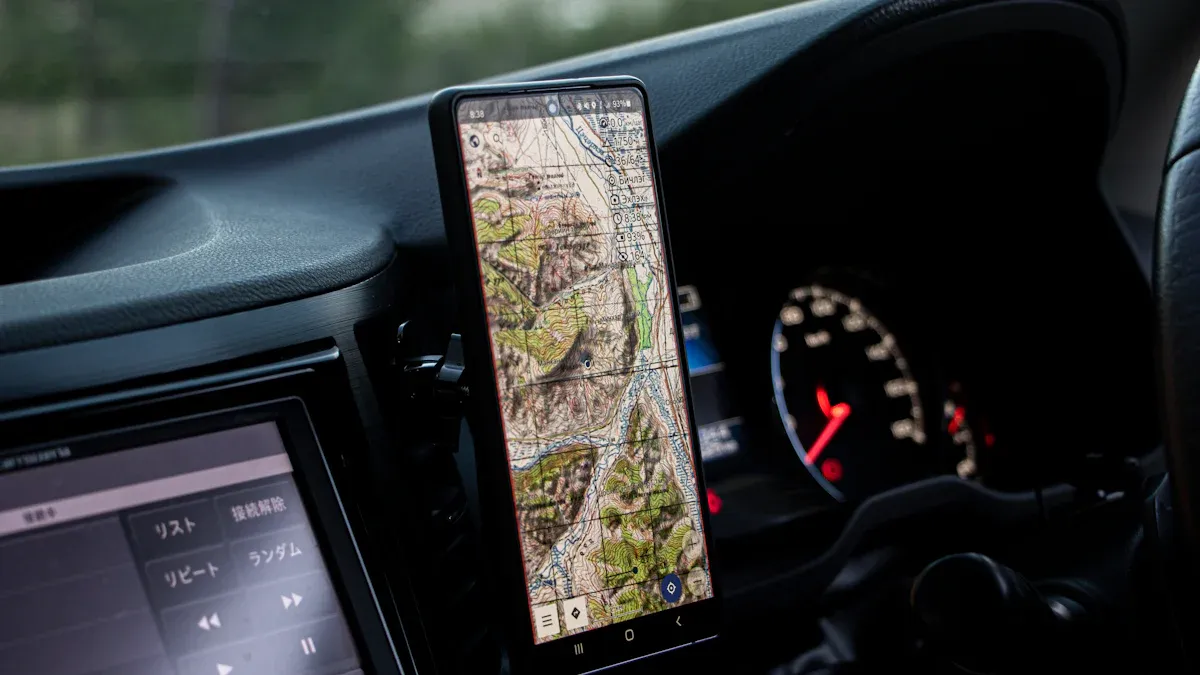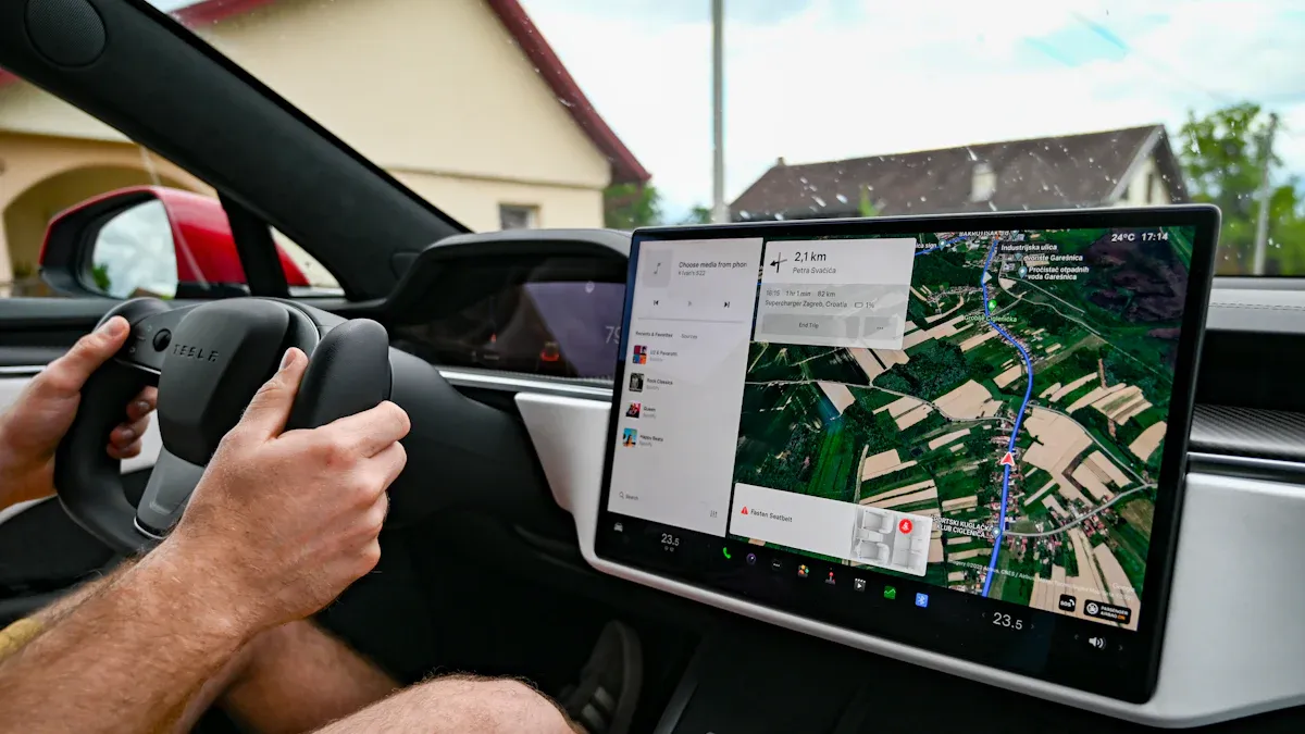
GNSS-Triggered Digital Signage for Vehicles lets you show digital messages based on where your vehicle is. When your vehicle moves, the GNSS system finds its location. The system in the vehicle then makes digital screens show the right message at the right time. You get updates and alerts that fit your route. This system helps you get useful and quick details while you ride in vehicles.
Key Takeaways
GNSS technology lets vehicles show digital messages at the right place without anyone pressing a button. This system makes travel better by giving updates, local ads, and safety alerts in real time. These alerts help keep passengers safe and informed. Advanced sensors and data sharing help keep the vehicle’s location correct. They also make sure the digital content is new, even in busy or hard places. Digital signage changes by itself with geofencing. It shows the right message when the vehicle goes into certain areas. Good GNSS receivers and computers in the vehicle work together. They give clear and fast messages and help keep your data safe from hackers.
GNSS-Triggered Digital Signage for Vehicles

What It Means
You see screens inside many vehicles today. These screens can show you maps, ads, or alerts. When you use gnss-triggered digital signage for vehicles, the screens change what they show based on where you are. The system uses signals from satellites to find your exact spot. You do not need to press any buttons. The digital display updates by itself. You get the right message at the right time. For example, when your bus gets close to a stop, the screen can show the name of the stop. If your train passes a famous place, the screen can tell you about it.
Tip: With gnss-triggered digital signage for vehicles, you always see information that matches your location.
Why It Matters
You want your ride to be smooth and helpful. Gnss-triggered digital signage for vehicles makes this possible. You get real-time updates that help you plan your trip. You see digital ads for stores or events near your route. You also get safety alerts if there is a problem ahead. This system helps you feel more informed and safe.
Here are some reasons why gnss-triggered digital signage for vehicles matters:
You get local news and alerts while you travel.
You see digital ads that fit your location.
You receive safety messages right when you need them.
Gnss-triggered digital signage for vehicles changes how you experience travel. You get more value from your time in vehicles. You stay connected and aware, thanks to smart digital technology.
How It Works
GNSS Positioning
You use global navigation satellite systems to find your vehicle’s spot. These systems, like the global positioning system, have many satellites in space. The satellites send signals down to your vehicle. Your receiver in the vehicle picks up these gnss signals. It figures out your location by timing how long the signals take to reach you. This gives you real-time positioning. Real-time positioning is important for digital signage triggers.
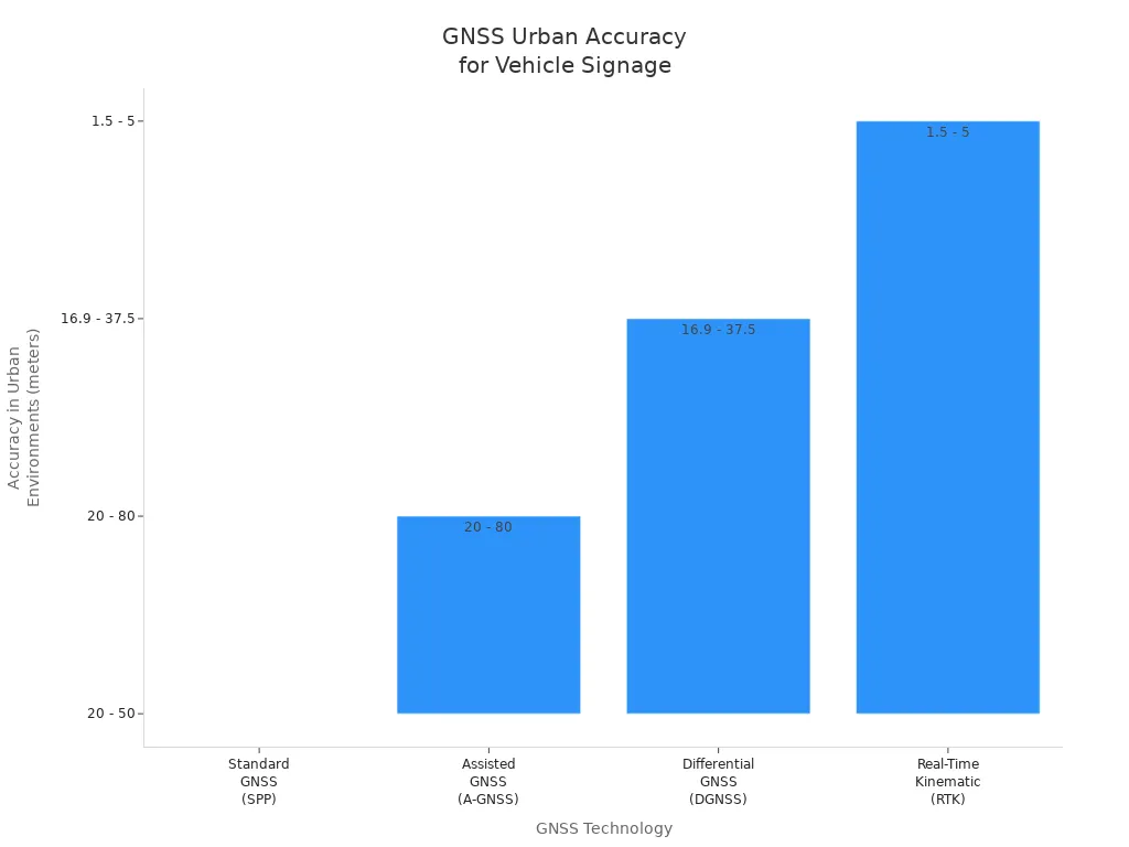
In open places, standard positioning is accurate within 3 to 5 meters. In cities with tall buildings, signals can bounce or get blocked. This makes positioning less exact. Advanced methods, like shadow matching and high-definition GNSS, help a lot. They mix satellite signals with visual sensors and digital maps. These methods can make positioning accurate to 10-20 centimeters, even in busy cities. Shadow matching uses 3D city models to guess which signals should reach your vehicle. It checks this against the signals your vehicle actually gets. This helps fix mistakes and lets your navigation system know your spot.

The chart shows that advanced positioning, like Real-Time Kinematic (RTK), is more accurate in cities than standard GNSS. But these systems can cost more money and might not work everywhere.
Note: Good positioning needs strong, clear signals. Tall buildings, tunnels, or bad weather can block or bounce signals. This makes it harder for your system to know your exact spot.
Data Communication
Your vehicle’s navigation system does more than just get signals. It also needs to share and update information fast. As your vehicle moves, sensors like cameras, LiDAR, and IMUs collect data about what’s around you. The onboard computer looks at this data right away. It matches the data with digital maps to check your position and spot changes.
Here’s how the data communication process works:
Step/Component | Description |
|---|---|
Sensors | Vehicles use GNSS (high-precision RTK mode ~20 cm accuracy), cameras, LIDAR, IMU, radar for environment sensing. |
Onboard Processing | Real-time semantic segmentation, SLAM, and vectorization of perception data performed on high-performance computing platforms. |
Map Matching | Vectorized perception data is matched against pre-existing HD maps to detect unchanged and new map elements. |
Crowdsourcing Data Upload | Raw data, keyframes, or recognized results are uploaded to the cloud to optimize bandwidth and processing. |
Cloud Aggregation | Crowdsourced data from multiple vehicles is aggregated and processed in the cloud to update HD maps dynamically. |
Map Update Distribution | Updated HD map packages are pushed back to vehicles, enabling real-time map content updates as vehicles traverse GNSS-defined zones. |
This system keeps your vehicle’s navigation and digital signage up to date. AI-powered maps use real-time data from many vehicles, sensors, and satellites. These maps change as you drive. They show new traffic, road work, or weather. Your vehicle gets these updates and uses them to change navigation and digital content.
Tip: Fast data sharing means your digital signage always shows the newest and best information as you travel.
Content Triggering
Once your vehicle knows its spot, the system uses this to trigger digital signage. The logic often uses geofencing. Geofencing sets up invisible lines around real places. When your vehicle enters or leaves these zones, the system shows certain digital content.
For example, if your bus gets close to a shopping area, the system finds your spot using gnss signals. It then shows an ad for a nearby store on the screen. If your train is near a station, the system shows arrival times or safety alerts. The system can also use beacons, like Apple’s iBeacon or Google Eddystone, to trigger content based on your exact spot.
To make these triggers work well, your vehicle’s system uses data from many sensors. High-precision GNSS, IMUs, and LiDAR all work together. Sensor fusion algorithms, like Kalman filters, mix these data sources. This helps your system keep good positioning, even when signals are weak or blocked. Advanced algorithms also figure out your vehicle’s direction. This way, the digital signage always matches your movement.
You get the right digital content at the right time because of this technology. The system updates by itself as you move through different zones. This makes your ride more helpful and interesting.
System Components
GNSS Receiver
The GNSS receiver helps find where your vehicle is. It listens to signals from satellites like GPS, GLONASS, Galileo, and BeiDou. The best receivers use more than one satellite system and frequency. This makes your results more accurate and reliable. When you pick a GNSS receiver for digital signage, look for these things:
It works with many satellite systems and frequencies for better accuracy.
It has a tough design for moving vehicles.
It uses two antennas to know which way you are going.
It starts up fast and updates your location quickly.
It has safety features to stop theft and jamming.
Tip: A good GNSS receiver keeps your digital signs working in busy cities.
Onboard Computer
The onboard computer is the system’s brain. It gets data from the GNSS receiver and other sensors. This computer looks at the data fast and decides when to show digital content. It connects to the internet with WiFi, Bluetooth, or cellular networks. This lets you update content and check the system from anywhere. The onboard computer also keeps your data safe with firewalls and VPNs.
Digital Display
You see digital screens in lots of vehicles now. These screens show ads, maps, and alerts. Most vehicles use LCD or LED screens for clear pictures. Some taxis and buses have bright LED displays on the roof. Inside, you might see screens with updates or fun shows. These screens can handle bumps and shakes while driving. They also let you update what they show from far away.
They resist bumps and shakes for use in vehicles.
You can update the content from anywhere.
Note: Digital displays help you get important messages wherever you go.
Content Management
Content management systems control what shows on each screen. You can set up ads, alerts, or info based on where your vehicle is. These systems use GNSS data to show the right message at the right time. Many let you manage and update content from far away and in real time. Here’s how content management works:
Aspect | Description |
|---|---|
Tracks your vehicle’s spot in real time to show location-based content. | |
Network Connectivity | Uses fast 5G or WiFi for smooth updates and good digital content. |
Remote Management | Lets you schedule, update, and check screens from anywhere using web or cloud tools. |
Security Features | Keeps your system safe with VPNs and firewalls. |
Operational Benefits | Shows dynamic, targeted ads and info to help people and make things work better. |
You can make your own messages, watch how things are going, and change your ads to fit your needs. This makes your digital signs smarter and more useful.
Use Cases

Route-Based Ads
You see ads on buses and trains every day. These ads change as your vehicle moves. GNSS-triggered systems show ads that fit your location. For example, if your bus goes by a mall, you might see a store ad. If your train is near a stadium, you could see a game ad.
Here are some real-world examples:
Location / System | Application Description | GNSS-Triggered Aspect / Route-Based Advertising Feature |
|---|---|---|
Netherlands (ProRail) | Digital signs on trains show open seats and where to board. This helps people get on and off faster. | Uses sensors and GPS to give real-time info about where you are. |
Vancouver (TransLink Network) | Shows news, weather, and ads to riders while they wait or ride. | Content changes based on the vehicle’s GPS location. |
Washington Metro Rail System | Digital signs give updates and alerts about service changes. This helps people plan their trips. | Uses GNSS-triggered signs to give travel info that fits where you are. |
Tip: Route-based ads help you find stores, events, and services as you travel.
Passenger Info
You want to know what is happening during your trip. GNSS-triggered signs give you updates in real time. You see the next stop and when you will get there. You also see where to change trains or buses. This helps you plan and not miss your stop. Many vehicles show maps and directions on screens. You can also get alerts about delays or changes. This makes your ride easier and less stressful.
See the next stop before you get there.
Get alerts if there are delays or changes.
Find where to switch to another bus or train.
Safety Alerts
Safety is important when you travel. GNSS-triggered systems help keep you safe with alerts. If your vehicle gets close to road work, you see a warning. If there is an emergency, you get clear steps to follow. These alerts help you stay aware and know what to do if something happens.
Note: Safety alerts make your ride safer by giving you the right info at the right time.
Benefits and Challenges
Advantages
GNSS-triggered digital signage in vehicles gives you many benefits. One big benefit is automation. You do not need to change the content yourself. The system uses satellite signals to find your location. It shows the right message at the right time. This saves you time and lets you do other things.
Automation lets you set up over 500 actions. You can pick alerts, pop-ups, emails, or control the vehicle.
Routine jobs happen by themselves, so you do less work.
You get updates right away, so your maps stay correct and passengers see new info.
GNSS data helps vehicles move safely, even in busy places like docks or city streets.
Geofences help you control where vehicles go and stop problems.
Tip: Automation and fast updates help you fix issues before they get worse.
Challenges
GNSS-triggered systems can have some problems. Signals can get lost or blocked in tunnels, parking garages, or cities with tall buildings. When this happens, your navigation may not work well. Privacy and cybersecurity are also important. You must keep your data safe from hackers.
Challenge | What You Need to Know |
|---|---|
Signal Loss & Interference | Signals can drop in tunnels or near tall buildings. Using more satellites and mixing sensor data helps your navigation keep working. |
You must keep your system safe from hackers who might steal or change your data. | |
System Integration | Your digital signs must work well with other vehicle systems and follow safety rules. |
Vehicles need safe and quick ways to share data, like V2X, to keep info up to date. |
Multi-constellation GNSS uses more than one group of satellites, like GPS and GLONASS, to give you better signal coverage. Sensor fusion mixes data from different sensors, so your navigation keeps working even if some signals are lost. This makes your system more reliable and accurate, even in tough places.
Now you know how GNSS helps vehicles share the right info. This technology gives updates that match where you are. Operators can change content easily and keep people updated. New improvements will make these systems smarter and more reliable. You can look forward to safer and smoother rides as GNSS and smart screens get better.
FAQ
How does GNSS know your vehicle’s location?
GNSS gets signals from satellites in space. Your vehicle’s receiver listens for these signals. It figures out where you are by timing the signals. This lets you see updates as you travel.
Can digital signage work if the GNSS signal drops?
If the GNSS signal stops, the system uses backup sensors like IMUs or saved map data. You still get important messages on the screen. When the signal comes back, the system updates again.
Is your personal data safe with GNSS-triggered signage?
You do not have to worry about your data. Most systems do not keep your personal details. They only use your vehicle’s location. Security tools like VPNs and firewalls help keep your info safe.
What happens if the vehicle enters a tunnel?
The GNSS signal might not work in tunnels.
The system uses backup sensors to keep showing content.
When you leave the tunnel, GNSS updates your location again.
See Also
Best GPS Units for Motorcycles Featuring CarPlay And Android Auto
Best HDMI Dongles Supporting CarPlay For 4K Streaming 2025
Comparing The Best CarPlay Dongles That Support Netflix Streaming
